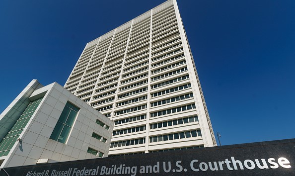
Randy Cox, paralyzed following arrest, sues for $100M

David Taludkar/Getty Images

(NEW HAVEN, Conn.) — The man who became paralyzed from the chest down while handcuffed in police custody has filed a federal lawsuit against the city of New Haven and New Haven Police Department officers for $100 million.

According to the lawsuit, Randy Cox, 36, was sitting handcuffed, but otherwise unrestrained, in the back seat of a police van on June 19 when Officer Oscar Diaz abruptly hit the brakes. Former acting police chief Regina Rush-Kittle said in June that this was an evasive maneuver to avoid an accident. Cox was thrown across the back of the van and immediately could not move his body, the lawsuit said.

Cox’s family and his attorneys said the injuries sustained in the vehicle and the alleged neglect from other officers have left him unable to care for himself and leaves him with little opportunity to earn a living for the rest of his life.

“We think that there is no value that can replace the damages and the hurt and the harm and the mental anguish and the torture that he’s endured every day, every hour, every minute, every second, every second of his life,” attorney Ben Crump, who is representing the family, said in a news conference Tuesday afternoon announcing the lawsuit. “We did not have to file this lawsuit to tell you why the city needs to do the right thing.”

Crump said at least $20-30 million is necessary to maintain Cox’s “basic quality of life.”

Video of the incident released by police showed Cox was handcuffed but not secured by a seatbelt in the back of a police van when a sudden stop caused him to fall headfirst into the van wall. Cox had been arrested and charged with criminal possession of a firearm and breach of peace. As of Tuesday, these charges are still active and awaiting a plea.

After he was “violently thrown” across the van, Cox shouted that he was hurt. Oscar Diaz, the officer who the suit alleges negligence; recklessness; excessive force; denial of medical treatment; and failure to provide medical assistance, said he couldn’t pull over immediately, but did so two minutes later, according to the complaint. Diaz then called 911 so an ambulance could meet them at the detention center.

After arriving at the detention center, before the ambulance arrived, Diaz and other officers removed Cox from the back of the transport wagon, the suit said.

At the center, Cox “indicated several times that he could not move and he thinks he broke his neck,” the suit said. Despite Cox’s plea, the suit said the officers attempted to move him and “place him in a wheelchair to be processed and eventually dragged him to a cell by his shoulder while still in handcuffs.”

Body camera footage shows New Haven officers dragging Cox out of the van, moving him into a wheelchair and asking him, “How much did you have to drink?” followed by statements like, “He is perfectly fine.”

Cox’s sister LaToya Boomer said at a press conference on Tuesday that she wonders how her brother, who was readmitted to the hospital Tuesday for bedsores, would have been progressing had he not been moved so much, or at all, after he was thrown from his seat in the van.

“We don’t want any lip service, we want action,” she said. Boomer called for criminal charges to be raised against officers, saying she wants those responsible for her brother’s injuries to be “fired and arrested.”

Doreen Coleman, Cox’s mother, has taken on the role of her son’s primary caregiver son after the incident. She asked officers to hold themselves accountable for their actions. “Own up to it,” she said at the press conference.

The named defendants, officers Diaz, Betsy Segui, Ronald Pressley, Jocelyn Lavandier, and Luis Rivera, are currently on leave, pending the results of a state investigation into their actions, police said.

Segui declined ABC News’ request for comment; Pressley, Lavandier, and Rivera have not responded. Diaz was not able to be reached.

“I’m not gonna say what those officers felt, but it seems like they thought he was intoxicated. So they weren’t taking his claims as legitimate,” New Haven Police Chief Karl Jacobson said in an interview with ABC News on Tuesday. “We as a police department, especially [with] someone in custody, need to take everybody’s claims legitimately, and build that legitimacy with the community.”

New Haven Mayor Justin Elicker told ABC News that, pending the outcome of the investigation, discipline for officers could potentially include being fired. The lawsuit did not come as a surprise for Jacobson and Elicker, who have spoken with Cox’s family, attorneys, and spent time with Cox.

“We are deeply committed to making sure something like this never happens again, and also to ensure that Randy gets justice. And we’ve implemented a lot of different policies, training in the police department to ensure that something like this doesn’t happen again,” Elicker said. “We’ll continue to talk with our attorneys [throughout] this process.”

“What happened to Randy was not right. We’re doing everything possible to ensure that it doesn’t happen to anyone else. And that’s all we can do,” Jacobson said. “We can take the next right step and I feel like we’re doing that to make you know, this such a terrible situation a better situation where, you know, Randy can move on in his life and have what he needs, and we can fix the wrongs in the police department so that this doesn’t happen again.”

The Connecticut State Police are still investigating the incident.

Earlier this year, the U.S. Justice Department said it was closely watching the investigation into the circumstances that left Cox paralyzed.

“All suspects taken into police custody must be afforded timely and appropriate medical care in the event of an emergency,” said U.S. Attorney Vanessa Roberts Avery in a statement in July. “If federal action is warranted, the Justice Department will pursue every available avenue to the full extent of the law.”

Copyright © 2022, ABC Audio. All rights reserved.

Mountain lion attacks 7-year-old boy from behind in park

KABC-TV

(LOS ANGELES) — A 7-year-old boy is recovering after being attacked from behind by an aggressive mountain lion while walking through a park Monday, authorities say.

The incident took place at Pico Canyon Park, located near Santa Clarita, California, in Stevenson Ranch, when authorities from the Department of Parks and Recreation in Los Angeles County say the boy was suddenly attacked and bitten by a mountain lion as he made his way through the park.

“The young boy — about 7-year-old boy — was walking up some stairs and was attacked from behind by a mountain lion and bitten in the buttocks,” Capt. Patrick Foy from the California Fish and Wildlife Department told Los Angeles ABC station KABC-TV in an interview following the incident.

The boy suffered non-life-threatening injuries in the attack and is expected to make a full recovery, officials said. The park will now remain closed until further notice while authorities carry out their investigation.

“According to Fish and Wildlife authorities, the investigation is being carried out as if this were a confirmed attack, however, the investigation is still ongoing,” said the Department of Parks and Recreation in a statement obtained by ABC News.

As part of the investigation, the boy’s bite wounds were swabbed for DNA to see if they could match it to a known wild cat in the area but, so far, the mountain lion has not been found, according to KABC.

Officials tracking the mountain lion placed a trap in the closed off park to see if they could lure the animal out from hiding.

“In the trap we placed a mountain lion’s favorite food, which is a deer carcass,” Foy told KABC.

If the cat is found and the DNA samples match the boy’s wounds, there is a good chance the mountain lion would be destroyed by authorities.

“Everything we do and every part of our mission is to better help wildlife and people coexist.” Foy explained to KABC. “Having a situation like this where wild animals start attacking — especially small children — that is a super difficult part of our job.”

In the meantime, there are plenty of local area residents who are concerned about their own safety following the sudden attack.

“You gotta understand when you are walking these trails the dangers that you are walking into. … It still terrifies me,” Francisco Salas of Santa Clarita told KABC. “It could happen to me. It could happen to anybody out here.”

Copyright © 2022, ABC Audio. All rights reserved.

Hurricane Ian live updates: These towns ‘decimated’ as storm wreaks havoc

ABC News

(NEW YORK) — Hurricane Ian strengthened into a powerful Category 4 hurricane on Wednesday morning, hours before it was expected to make landfall along Florida’s Gulf Coast.

Landfall is expected between afternoon and early evening in the area near Port Charlotte and Sarasota, though the hurricane’s track, timing and intensity may change.

Florida Gov. Ron DeSantis has declared a state of emergency.

Here’s how the news is developing. All times Eastern:

Sep 28, 9:28 PM EDT
Jacksonville mayor announces closure of 3 major beaches

Jacksonville Mayor Lenny Curry announced Wednesday evening that the city is closing Atlantic, Neptune and Jacksonville beaches ahead of Hurricane Ian’s impact on the area.

“We will reopen as soon as it’s safe for citizens,” Curry tweeted.

Sep 28, 9:26 PM EDT
Over 1.9 million customers without power in Florida

The number of customers without power in Florida has topped 1.9 million, as Hurricane Ian continues making its way across the state.

Most of the outages are in the southern Gulf side of the state, primarily in Lee, Collier, Charlotte and Sarasota counties.

The outages are moving east as the storm moves across the state.

-ABC News’ Darren Reynolds

Sep 28, 9:13 PM EDT
Ian downgraded to Category 2 hurricane

Hurricane Ian has been downgraded to a Category 2 storm as of a 9 p.m. ET update, with winds now at 105 mph.

-ABC News’ Riley Winch

Sep 28, 8:30 PM EDT
Extreme wind warning issued for central Florida counties

Hurricane Ian remains a Category 3 storm as of an 8 p.m. ET update, with winds dropping to 115 mph.

The National Weather Service issued a new Extreme Wind Warning for Highlands, Hardee, Charlotte, Polk and DeSoto Counties in central Florida until 9:30 p.m. ET.

-ABC News’ Riley Winch

Sep 28, 7:31 PM EDT
‘We hear your calls’: Sheriff

Lee County has received more than double the number of 911 calls it typically receives amid Hurricane Ian, according to Sheriff Carmine Marceno, as first responders have suspended their emergency response during the major storm.

“We hear your calls and are aware that Hurricane Ian was a powerful and devastating weather event,” Marceno said in a social media post Wednesday evening. “We want to get to you. We want to save you. As soon as safely possible, our assets are ready to deploy to come to your aide.”

Ben Abes, Lee County’s public safety director, said current conditions, including flooding, make it “impossible” for first responders to go out. He said the county is tracking 911 calls and prioritizing them once first responders are able to act after the hurricane passes.

“We are aware of a number of calls of people who are stranded due to high water,” he said during a press briefing Wednesday evening. “This is a scary situation. We urge you not to panic.”

Lee County, which is home to hard-hit Fort Myers, Sanibel and Bonita Beach, issued a countywide curfew Wednesday evening due to the storm that is in effect until further notice.

Sep 28, 7:15 PM EDT
Ian downgraded to a Category 3 hurricane

Hurricane Ian has weakened to a Category 3 storm hours after making landfall near Fort Myers as a major hurricane.

While the strength of the storm has diminished slightly, Ian is still wreaking havoc on the Sunshine State as a devastating storm.

The highest wind gust measured at 132 mph at Port Charlotte, and maximum sustained winds are currently at 125 mph, according to the National Hurricane Center’s 7 p.m. advisory.

Water levels in Fort Myers have been reported at more than 7 feet, the advisory states.

-ABC News’ Riley Winch

Sep 28, 7:10 PM EDT
Sanibel, Fort Myers Beach ‘decimated’ by Ian, local officials say

Sanibel Island and Fort Myers Beach have been “decimated” by Ian after the major hurricane made landfall there.

About 75% of Lee County is without power, and several people are stranded due to high water, officials from Lee County Emergency Management announced during a press conference Wednesday afternoon.

A curfew in Lee County was implemented beginning at 6 p.m. Wednesday. Forecasts predict that it will not be safe to venture outside in the region until 5 a.m. on Thursday, officials said.

The number of injuries or fatalities is not yet clear, officials said, adding that the recovery efforts will take months.

-ABC News’ Will Gretsky

Sep 28, 6:38 PM EDT
Wind gusts in eye wall measure at 104 mph

A National Oceanic and Atmospheric Administration station in Venice Beach, Florida, has measured wind gusts of 104 mph within the northern eye wall of Hurricane Ian, according to the 6 p.m. storm advisory.

The storm is currently battering the Florida peninsula with catastrophic storm surge, winds and flooding, according to the National Hurricane Center.

Maximum sustained winds measured at 130 mph, and the storm system has begun churning even slower at 8 mph north-northeast — toward the east coast of the state.

-ABC News’ Melissa Griffin

Sep 28, 6:33 PM EDT
‘Massive mobilization’ of utility trucks on the way to Florida, governor says

A caravan of utility trucks is making its way from several states toward the parts of Florida most battered by Hurricane Ian to restore power after the worst of the storm has passed, Florida Gov. Ron DeSantis announced during a news conference Wednesday afternoon.

“We have a massive, massive mobilization,” DeSantis said, adding that workers are coming from other southern states accustomed to hurricane cleanup, such as Texas and Louisiana.

More nearly 1.5 million customers in Florida were without power Wednesday as Ian made landfall near Fort Myers.

Ian continued to batter a large swath of Florida at 6:15 p.m. ET, with life-threatening storm surge all along the southwest coast — up to 12 feet in some places, DeSantis said.

Downtown Naples was reportedly completely flooded due to record storm surge, and while there were also reports of structural damage in Lee County, DeSantis said.

“This was a top five hurricane to ever hit the Florida peninsula,” the governor said.

DeSantis said that devastating inland flooding was inundating much of the regions experiencing hurricane conditions, as well.

DeSantis has declared a major disaster in the state.

-ABC News’ Will Gretsky

Sep 28, 6:13 PM EDT
Fort Myers, Naples issue curfews

The city of Fort Myers in southwest Florida has issued a citywide curfew “to protect and safeguard the health, safety and welfare of residents, visitors and first responders.” The curfew started at 6 p.m. Wednesday and will be in effect for the next 48 hours.

Down the coast, the city of Naples also issued a citywide curfew earlier Wednesday afternoon, effective immediately until further notice.

Naples reported record storm surge Wednesday morning, before Ian made landfall.

Sep 28, 4:54 PM EDT
Ian makes 2nd landfall on Florida mainland

Hurricane Ian made a second landfall just south of Punta Gorda with maximum sustained winds of 145 mph.

Ian made initial landfall on a barrier island near Cayo Costa just after 3 p.m.

Sep 28, 4:48 PM EDT
South Carolina, North Carolina issue states of emergency

The governors of South Carolina and North Carolina each issued states of emergency on Wednesday afternoon in preparation for Ian’s arrival.

South Carolina Gov. Henry McMaster said no evacuations or school closures have been ordered yet.

North Carolina Gov. Roy Cooper said the decision would help first responders and farmers and protect customers from price gouging.

The storm is expected to cross Florida and enter the Atlantic before making landfall again along the South Carolina coast over the weekend.

Sep 28, 4:13 PM EDT
Over 1 million power outages

Over 1 million Florida customers were without power on Wednesday just after Ian made landfall.

The majority of outages were along the west coast in Sarasota, Lee, Charlotte and Collier counties.

Sep 28, 3:12 PM EDT
Ian makes landfall as Category 4

Hurricane Ian made landfall on Florida’s west coast Wednesday afternoon as a powerful Category 4 storm, slamming the coastline with powerful 150 mph winds and dangerous storm surge.

Landfall was at about 3:05 p.m. ET near Cayo Costa, an island off the coast of Fort Myers.

For southwest Florida, Ian “will probably be the big one that they always remember,” Florida Gov. Ron DeSantis said.

The governor said Ian will likely stay in the state until Thursday, exiting from Daytona Beach.

Sep 28, 2:07 PM EDT
Biden to visit FEMA on Thursday

President Joe Biden will visit FEMA headquarters in Washington, D.C., on Thursday to receive an update on Hurricane Ian, White House press secretary Karine Jean-Pierre said.

“We have deployed significant federal resources to the region to help prepare for the hurricane,” Jean-Pierre said at Wednesday’s press briefing. “We have more than 1,300 federal response workers on the ground in Florida. … Three-hundred Army Corps personnel are on the ground to support power and fuel assessments. Three-hundred ambulances are supporting local officials, and multiple federal disaster medical assistance teams are deployed to Florida and Georgia.”

Sep 28, 1:33 PM EDT
Counties suspend emergency response calls

Sarasota County, Florida, officials announced emergency crews will no longer respond to calls due to Hurricane Ian.

In Charlotte County, just north of Fort Myers, emergency response calls for fire and EMS service will also be suspended.

The Charlotte County Sheriff’s Office added, “911 will still be operational and calls will be triaged for response as soon as weather condition permit.”

Sep 28, 1:25 PM EDT
Naples issues curfew

The city of Naples, in southwest Florida, has issued a citywide curfew, effective immediately until further notice.

Naples has reported a wind gust of 112 mph as Hurricane Ian inches closer to shore.

Sep 28, 1:03 PM EDT
Extreme wind warning issued

An extreme wind warning has been issued near Fort Myers as Hurricane Ian nears.

Naples has reported a wind gust of 112 mph.

Fort Myers resident Debbie Levenson and her husband chose not to evacuate for Hurricane Ian and are staying put at home.

“Hurricanes are a concern, but I don’t freak out about it. You do what you have to do. You get your supplies, make sure you have flashlights, do your laundry ahead of time in case you lose power,” she told ABC News. “We bought bottled water and wine. We put gas in the car. The store shelves were not empty.”

“We are concerned with local flooding, but we drained the pool and are keeping an eye on the roads,” she continued. “Most of the neighborhood has stayed. Neighbors only left if they had small children or had a medical reason.”

Ken Graham, director of NOAA’s National Weather Service, warned people sheltering in place to not venture out once the storm passes over.

“Don’t go out there. It’s so dangerous to be out there. So even if you see the water receding, it’s not the time to go out,” he said.

-ABC News’ Morgan Korn and Max Golembo

Sep 28, 12:03 PM EDT
Ian nears record-breaking winds

Hurricane Ian, a Category 4 with 155 mph winds, is nearing record-breaking wind levels.

Only four hurricanes have ever made landfall in the continental U.S. with winds over 155 mph: Labor Day in 1935 with 185 mph winds; Camille in 1969 with 175 mph winds; Andrew in 1992 with 165 mph; and Michael in 2018 with 160 mph.

Sep 28, 11:53 AM EDT
Naples sees record storm surge

Naples, Florida, reached a new record-high storm surge of 4.8 feet Wednesday morning — and the water continues to rise.

This beats the record of 4.25 feet reached during Hurricane Irma in 2017.

Ken Graham, director of NOAA’s National Weather Service, warned Wednesday, “This is going to be a storm we talk about for many years to come — historic event.”

Sep 28, 11:13 AM EDT
Ian’s eyewall moving on shore

Hurricane Ian’s eyewall is moving on shore.

The powerful Category 4 storm is set to bring catastrophic storm surge, winds and flooding.

Sanibel Island has reported sustained winds of 58 mph with a wind gust reaching 75 mph.

Sep 28, 10:45 AM EDT
Over 2,000 flights canceled

The airports in Orlando, Miami, Tampa and Fort Lauderdale are leading the world in flight cancellations Wednesday morning.

Over 2,000 flights have been canceled within, into, or out of the United States on Wednesday.

Another 1,600 flights are already cancelled for Thursday.

The Tampa International Airport will remain closed through Thursday.

-ABC News’ Ahmad Hemingway and Sam Sweeney

Sep 28, 10:00 AM EDT
Over 172,000 power outages

Over 172,000 Florida customers are without power on Wednesday morning as Ian nears.

Sep 28, 9:09 AM EDT
18 feet of storm surge possible

Up to 18 feet of dangerous storm surge is forecast along Florida’s Southwest coast, including Englewood, Bonita Beach and Charlotte Harbor.

FEMA Administrator Deanne Criswell warned Tuesday that her biggest concern with Ian was storm surge.

“In 2018, when Hurricane Michael impacted the Florida Panhandle, there were five recorded fatalities as a result of storm surge,” she noted.

Sep 28, 8:32 AM EDT
Gov.: Treat storm like tornado approaching your home

Florida Gov. Ron DeSantis warned Wednesday morning that Ian could potentially make landfall as a Category 5 hurricane.

“This is a powerful storm that should be treated like you would treat a tornado approaching your home,” he said. “This one has just strengthened and strengthened, and it is the real deal. So, it is going to do a lot of damage, so people should be prepared for that.”

More than 200 shelters are open in South Florida, he said.

Twenty-six states, including New York and New Jersey, have sent support to Florida, he said.

Sep 28, 7:41 AM EDT
Winds near Category 5 as storm approaches Florida

Hurricane Ian approached Category 5 status at about 6:30 a.m. ET, with its winds topping out at 155 mph.

Only four hurricanes have ever made landfall in the continental U.S. with winds over 155 mph: Labor Day in 1935 with 185 mph winds; Camille in 1969 with 175 mph winds; Andrew in 1992 with 165 mph; and Michael in 2018 with 160 mph.

Severe Category 5 hurricanes have winds above 157 mph.

“Rapidly intensifying Ian forecast to cause catastrophic storm surge, winds, and flooding in the Florida peninsula,” the National Hurricane Center said at 7 a.m. ET.

Sep 28, 7:23 AM EDT
16 feet of storm surge possible

A whopping 16 feet of storm surge is possible around Fort Myers.

Up to 11 feet of storm surge is forecast for Naples while a maximum of 10 feet is expected for the Sarasota area.

“Our biggest concern as we wait for this storm to make landfall is storm surge,” FEMA Administrator Deanne Criswell warned Tuesday. “In 2018, when Hurricane Michael impacted the Florida Panhandle, there were five recorded fatalities as a result of storm surge.”

Sep 28, 7:15 AM EDT
Nearly 2,000 flights canceled

Florida’s airports are leading the world in flight cancellations Wednesday morning.

There are at least 1,903 flight cancellations within, into, or out of the United States for Wednesday.

Sep 28, 5:13 AM EDT
Ian strengthens to Category 4 hurricane

Hurricane Ian strengthened to a Category 4 hurricane on Wednesday morning, as its winds climbed to 140 mph, the National Hurricane Center said.

The storm is the first Category 4 hurricane in the Gulf of Mexico since Hurricane Rita in September 2005.

Sep 28, 3:06 AM EDT
Ian moves closer to Florida’s west coast

Hurricane Ian was moving closer to Florida’s west coast, the National Hurricane Center said in its 2 a.m. ET update on the storm’s position.

The eye of the Category 3 storm was about 95 miles southwest of Naples, Florida, and was moving north-northeast at about 10 mph, officials said.

“On the forecast track, the center of Ian is expected to approach the west coast of Florida within the hurricane warning area this morning, and move onshore later today,” the update said.

Officials said the storm was expected to pass over central Florida on Wednesday night and Thursday morning, before emerging over the Atlantic Ocean late Thursday.

The hurricane was “expected to cause life-threatening storm surge, catastrophic winds and flooding in the Florida peninsula,” the update said.

Sep 28, 2:28 AM EDT
Miami-Dade County suspends transit service

Officials in Miami-Dade County suspended transit services at 1 a.m. ET on Wednesday, as Hurricane Ian approached Florida.

Florida’s most populous county halted its Metrobus, Metrorail, Metromover and Special Transportation Services until further notice, officials said in a news release.

Sep 28, 12:24 AM EDT
DeSantis tells Floridians time to evacuate is ‘now’

Hurricane Ian is fast approaching Florida, and the time to leave is “now” if you’re in an evacuation zone, Gov. Ron DeSantis said late Tuesday during a press conference.

“Your time to evacuate is coming to an end. You need to evacuate now. You’re going to start feeling major impacts of this storm relatively soon,” the governor said. “Now is the time to do it, and now is the time to act.”

As of Tuesday night, about 8,000 people were without power in the southern part of Florida, officials said.

Conditions are expected to continue to deteriorate across central and south Florida, with landfall currently forecast sometime between Wednesday afternoon and early evening.

Elsewhere, a tropical storm warning is now in effect along the coast of Georgia and up to Charleston, S.C.

Sep 27, 10:31 PM EDT
Biden spoke with DeSantis, White House press secretary says

President Joe Biden spoke Tuesday night with Gov. Ron DeSantis ahead of Hurricane Ian’s arrival “to discuss the steps the federal government is taking to help Florida prepare,” White House press secretary Karine Jean-Pierre tweeted.

“The president and the governor committed to continued close coordination,” Jean-Pierre wrote.

Sep 27, 10:18 PM EDT
Cuba without power in wake of Hurricane Ian: Reports

Cuba has lost power after Hurricane Ian made landfall on the island Tuesday, according to reports.

There is “0 electricity generation” in the country, according to a National Electric System update.

“This complicated condition is also associated with complex weather conditions that have affected the SEN infrastructure,” the update said.

Sep 27, 8:33 PM EDT
Some Florida residents begin evacuating ahead of Ian’s landfall

Some Florida residents have begun evacuating their homes as Hurricane Ian approaches.

People are seeking shelter ahead of the storm, which is currently forecast to make landfall as a Category 4 hurricane sometime Wednesday afternoon.

Ian remains a Category 3 storm with maximum sustained winds of 120 mph as of Tuesday might.

It’s moving north-northeast at 10 mph and the center is located about 180 miles south-southwest of Punta Gorda, Florida.

There have been multiple tornado warnings in the area over the past few hours. A large tornado was reported on the ground in southern Broward County, near Davie, at around 7:30 p.m. ET.

Sep 27, 7:34 PM EDT
Satellite images show lightning-packed eye of Hurricane Ian

Hurricane Ian is barreling toward Florida, and satellite images show the eye of the storm packed with lightning as it strengthens over the Gulf of Mexico.

The storm is currently forecast to make landfall on Florida’s western coast on Wednesday between 1 and 6 p.m., somewhere between Port Charlotte and Sarasota.

See the latest maps and read more about Hurricane Ian’s projections and possible paths here.

Sep 27, 6:31 PM EDT
DeSantis on Hurricane Ian: ‘This thing is the real deal, it is a major, major storm’

Florida Gov. Ron DeSantis has urged Floridians to take Hurricane Ian seriously as the powerful storm heads to the state.

“You don’t get a mulligan when your personal safety is at risk,” he said during a press conference on Tuesday.

About 2.5 million people in the state are under evacuation orders.

“This thing is the real deal. It is a major, major storm,” DeSantis said.

-ABC News’ Darren Reynolds

Sep 27, 5:43 PM EDT
5,000 Florida Guardsmen activated and prepping for Hurricane Ian

Florida Gov. Ron DeSantis has activated 5,000 Florida National Guardsmen to armories across the state in preparation for Hurricane Ian, which is forecast to hit the state on Wednesday.

Roughly 2,000 National Guard members from neighboring states such as Tennessee are also being activated to assist, the Florida National Guard said in a statement Tuesday.

“The Florida National Guard is well-equipped, with assets including high-wheeled vehicles, helicopters, boats, generators and more,” the statement said.

The U.S. Navy has authorized non-essential personnel in various Florida counties to evacuate.

-ABC News’ Matt Seyler

Sep 27, 5:12 PM EDT
Landfall forecast for Wednesday afternoon or evening

Hurricane Ian, barreling north toward Florida with 120 mph winds, is now located about 230 miles away from Sarasota.

Ian is expected to make landfall in Florida on Wednesday afternoon or early evening.

Ian’s outer bands are already hitting South Florida, bringing a threat of heavy downpours, strong wind gusts, frequent lightning and even tornadoes. A tornado watch is in effect for South Florida until 5 a.m. Wednesday.

-ABC News’ Dan Peck

Sep 27, 4:51 PM EDT
Walt Disney World, Universal Orlando to close

Walt Disney World and Universal Orlando will close Wednesday and Thursday due to the storm.

Sep 27, 3:56 PM EDT
Coastal Georgia, South Carolina under tropical storm watches

As Ian moves north over Florida, tropical storm force winds will reach coastal Georgia and South Carolina.

Tropical storm watches have been issued for Savannah and near Charleston.

Georgia Gov. Brian Kemp has issued a state of emergency.

Sep 27, 2:57 PM EDT
Ian, a Category 3, expected to strengthen more

Ian, now a Category 3 hurricane with 120 mph winds, has strengthened on Tuesday and is forecast to strengthen even more into the night.

People walk through a flooded street in Batabano, Cuba, Sept. 27, 2022, during the…Read More

The latest track shows Ian making landfall on Wednesday, striking the west coast of Florida between Tampa and Fort Myers, bringing flooding and damaging winds.

Hurricane warnings are in effect from Tampa to Fort Myers and storm surge warnings are in effect for a large portion of Florida’s west coast.

There is also a risk for tornadoes in Florida Tuesday and Wednesday.

Sep 27, 2:34 PM EDT
FEMA: ‘Do not underestimate’ Ian

Federal Emergency Management Agency Administrator Deanne Criswell warned Tuesday, “Floridians are going to experience the impacts from the storm for a very long time.”

“Our biggest concern as we wait for this storm to make landfall is storm surge,” Criswell said. “In 2018, when Hurricane Michael impacted the Florida Panhandle, there were five recorded fatalities as a result of storm surge. So therefore, if people are told to evacuate by their local officials, please listen to them. The decision you choose to make may mean the difference between life and death.”

President Joe Biden on Tuesday urged residents to “evacuate when ordered.”

Biden said he spoke to the mayors of Tampa, St. Petersburg and Clearwater Tuesday morning and told them to “contact me directly” for “whatever they need.”

Criswell said a search and rescue coordination group has been activated, including members from FEMA’s urban search and rescue teams, the Coast Guard, the Department of Defense and the Department of the Interior.

The Red Cross has established 29 shelters and is prepared to open 60 more shelters if needed, she said.

Criswell stressed, “To those who may be watching at home, get ready and do not underestimate the potential that the storm can bring.”

Sep 27, 2:28 PM EDT
Orlando’s airport closing Wednesday

The Orlando International Airport said operations will stop at 10:30 a.m. Wednesday.

The St. Pete-Clearwater International Airport is closing at 1 p.m. Tuesday while Tampa International Airport is suspending flights at 5 p.m. Tuesday.

The Sarasota Bradenton International Airport is closing at 8 p.m. Tuesday while the Melbourne Orlando International Airport will stop flights at 2 p.m. Wednesday.

Sep 27, 12:25 PM EDT


Orlando’s airport closing Wednesday


The Orlando International Airport said operations will stop at 10:30 a.m. Wednesday.

The St. Pete-Clearwater International Airport is closing at 1 p.m. Tuesday while Tampa International Airport is suspending flights at 5 p.m. Tuesday.

Sep 27, 12:03 PM EDT
Coastal Georgia, South Carolina under tropical storm watches

As Ian moves north over Florida, tropical storm force winds will reach coastal Georgia and South Carolina.

Tropical storm watches have been issued for Savannah and near Charleston.

Sep 27, 11:13 AM EDT
Landfall in Florida forecast for Wednesday afternoon

Hurricane Ian’s track is moving south, with landfall forecast for late afternoon Wednesday between Tampa and Fort Myers as a Category 3 storm.

The storm surge forecast for Tampa Bay has dropped from 10 feet to 8 feet. But now the predicted storm surge for Fort Myers has increased and could be as high as 12 feet.


Sep 27, 9:41 AM EDT
Tornado watches issued in South Florida

Tornado watches have been issued in Miami, Fort Lauderdale, West Palm Beach, Naples and Key West as Hurricane Ian approaches.

The watches are in effect until 5 p.m. Tuesday.

Sep 27, 8:25 AM EDT
Latest forecast shows landfall in Tampa Bay area

The forecast has shifted significantly east, now with landfall expected in the Tampa Bay area Wednesday night into early Thursday morning as a Category 3 hurricane.

This would mark Tampa Bay’s first direct hit from a major hurricane since 1921.

Slow-moving Ian is expected to drop more than 15 inches of rain from Tampa to Orlando.

Major flooding is possible in Orlando, Tampa and St. Petersburg.

Sep 27, 5:00 AM EDT
Hurricane Ian makes landfall after strengthening to major storm

Hurricane Ian made landfall over western Cuba early on Tuesday morning, the National Hurricane Center said.

“Satellite and radar data indicate that the center of Ian has made landfall just southwest of the town of La Coloma in the Pinar Del Rio Province of Cuba at 4:30 a.m.,” the center said.

Ian’s winds at landfall were estimated at a maximum of 125 mph, making the storm a Category 3 hurricane.

Sep 26, 11:35 PM EDT
Ian strengthens as winds grow to 105 mph

Hurricane Ian continued to intensify Monday night, with maximum sustained winds now at 105 mph.

The hurricane is about 105 miles east-southeast of the western tip of Cuba, which is expected to see significant wind and storm surge impacts soon.

The storm is expected to become a major hurricane overnight or Tuesday morning.

Sep 26, 9:47 PM EDT
Tampa International Airport to close as Ian approaches

Tampa International Airport will stop all operations starting 5 p.m. Tuesday to secure its airfield and terminals ahead of Hurricane Ian’s expected landfall later this week.

Sep 26, 7:14 PM EDT
HHS secretary declares public health emergency for Florida

The U.S. Department of Health and Human Services has declared a public health emergency for the state of Florida.

HHS Secretary Xavier Becerra made the declaration Monday to address the possible health impacts for Florida residents once Hurricane Ian nears the state.

“We will do all we can to assist Florida officials with responding to the health impacts of Hurricane Ian,” Becerra said in a statement. “We are working closely with state, local, and tribal health authorities, as well as our federal partners, and stand ready to provide additional public health and medical support.”

HHS has pre-positioned two 15-person health and medical task force teams from its National Disaster Medical System, as well as a 13-person incident management team and two pharmacists to assist with the response in Florida.

“These teams are highly trained and ready to respond if, when, and where they may be needed following the storm,” HHS Assistant Secretary for Preparedness and Response Dawn O’Connell said.

Florida Gov. Ron DeSantis declared a state of emergency on Saturday. That declaration was approved by President Joe Biden on Sunday.

Sep 26, 6:59 PM EDT
Hurricane warning issued for Tampa Bay area

The National Hurricane Center has issued a hurricane warning for the Tampa Bay area just after its 5 p.m. advisory for Hurricane Ian.

The hurricane, currently a Category 2, is forecast to strengthen before it slows down as it approaches land. It is then expected to hover off the coast of Tampa from Wednesday into Thursday before making landfall.

A hurricane watch has also been issued for Big Bend, Florida, near the panhandle, and tropical storm warnings are in effect for much of southwest Florida.

Tropical storm watches are in effect for Orlando toward the northeast portion of the state, from Fort Pierce to Jacksonville.

-ABC News’ Melissa Griffin

Sep 26, 6:21 PM EDT
Florida utility company to use remote grid technology to restore power during the storm

The emergency response from Florida Power & Light is “well underway” as Hurricane Ian approaches, the utility company announced Monday.

FP&L has mobilized 13,000 workers, as well as supplies, to ensure the response is conducted as safely and quickly as possible after the storm hits, according to a press release.

As the hurricane begins to bear down on the region, FP&L will use remote grid technology to restore power remotely during the storm, as long as it is safe to do so, the company said. After the storm passes and winds drop below 35 mph, FP&L will continue restoration and conduct damage assessments with field crews.

The utility company also urged customers to make preparations and take safety precautions.

“As this storm approaches Florida, we know our customers are counting on us and we are determined to meet this challenge,” said Eric Silagy, chairman and CEO of FP&L in a statement. “We are mobilizing and pre-positioning our restoration workforce, so these brave men and women can quickly start working as soon as it is safe to do so.”

-ABC News’ Matt Foster

Sep 26, 3:58 PM EDT
Florida State University cancels classes

Florida State University has canceled classes Tuesday through Friday as Hurricane Ian approaches.

“The cancellation of classes on Tuesday is to allow students to travel safely out of the area if they so choose,” the university said. “Students who choose to stay in Tallahassee will be advised via the FSU Alert system to follow a ‘shelter in place’ protocol during the storm.”

Sep 26, 3:38 PM EDT
St. Pete-Clearwater International Airport to close

The St. Pete-Clearwater International Airport will close at 1 p.m. Tuesday due to the mandatory evacuation orders in Pinellas County. The airport will stay closed until the evacuation order is lifted.

Sep 26, 2:55 PM EDT
1st mandatory evacuation orders issued

Mandatory evacuation orders are in place for coastal parts of Hillsborough County, Florida. Over 300,000 people are expected to evacuate, officials announced Monday, with emergency shelters opening at 2 p.m. Monday.

Hillsborough County could face up to 15 feet of storm surge and 30 straight hours of tropical storm force winds, Florida Emergency Management Director Tim Dudley said.

County Administrator Bonnie Wise added, “We did not make this decision easily, but the storm poses a serious threat, and we must do everything we can protect our residents.”

Some residents of Sarasota County and Manatee County are also under mandatory evacuation orders.

-ABC News’ Alex Faul

Sep 26, 2:01 PM EDT
7,000 National Guardsmen deployed to help

Five-thousand members of the Florida National Guard have been activated to help during Hurricane Ian. Another 2,000 guardsmen from Tennessee, Georgia and North Carolina are also coming to help, Florida Gov. Ron DeSantis said.

Nearly 300 ambulances and support vehicles are being deployed to areas bracing for Ian’s landfall, DeSantis said.

-ABC News’ Alex Faul

Sep 26, 12:43 PM EDT
Tampa may shut down airport

In Tampa, where residents are bracing for 10 feet of dangerous storm surge, the Tampa International Airport may shut down parts of its airfield and facilities over the next day or two, airport officials announced.

The airport is in an evacuation zone, but because it’s critical infrastructure, it’s “exempt from the storm evacuation order and will stay open until a closure is necessary,” airport officials said in a statement.

It’s been 101 years since Tampa last had a direct hit from a major hurricane.

Sep 26, 11:36 AM EDT
Sarasota, Tampa-area schools close

Hillsborough County Public Schools in Tampa will be closed Monday through Thursday due to the storm. Instead, some schools will operate as storm shelters, the district said.

In Sarasota County, schools will be closed on Tuesday.

Sep 26, 11:34 AM EDT
First mandatory evacuation orders issued

Mandatory evacuation orders are in place for coastal parts of Hillsborough County, Florida. Over 300,000 people are expected to evacuate, officials announced Monday, with emergency shelters opening at 2 p.m. Monday.

Hillsborough County could face up to 15 feet of storm surge and 30 straight hours of tropical storm force winds, Florida Emergency Management Director Tim Dudley said.

County Administrator Bonnie Wise added, “We did not make this decision easily, but the storm poses a serious threat, and we must do everything we can protect our residents.”

Sep 26, 10:43 AM EDT
NASA rolling Artemis rocket back off launch pad

NASA said it will roll the Artemis I rocket off the launch pad and back to the vehicle assembly building on Monday night due to the storm.

“Managers met Monday morning and made the decision based on the latest weather predictions associated with Hurricane Ian, after additional data gathered overnight did not show improving expected conditions for the Kennedy Space Center area,” NASA said in a statement. “The decision allows time for employees to address the needs of their families and protect the integrated rocket and spacecraft system.”

Sep 26, 10:08 AM EDT
Floodwater safety tips to remember

As Ian approaches, here are a few commonsense strategies to help avoid unnecessary risk from floodwaters:

–Before flooding, look up your neighborhood’s flood zone and determine if your home or business is prone to flooding. Come up with an evacuation plan and make sure your car has a full tank of gas. Stock up on non-perishable foods.

–After flooding, ensure your drinking water is sanitized and wash your hands thoroughly after contact with floodwaters. Disinfect objects that have come into contact with floodwater before offering them to children or toddlers.

–Try to avoid exposure with floodwaters for long periods of time to prevent physical injury. Wear waterproof boots if you have them. Do not attempt to drive over flooded streets as it could damage the car and strand passengers.

Click here for more.

Sep 26, 10:01 AM EDT
White House closely monitoring Ian

The White House is “closely monitoring” the hurricane, a White House official told ABC News.

President Joe Biden approved Florida’s emergency assistance request this weekend “as soon as he received it,” the official said.

“He also directed his team to surge Federal assistance to the region well before landfall,” the official said. “FEMA has already deployed staff there and pre-positioned food, water, and generators.”

Biden was scheduled to travel to Florida on Monday but that trip has been postponed due to the storm.

-ABC News’ Karen Travers

Sep 26, 8:23 AM EDT
Hurricane watch issued for Tampa, Fort Myers, Naples

Ian is expected to become major Category 3 hurricane Monday night with winds of 115 mph.

As Ian passes Cuba, it’s expected to rapidly intensify, becoming a Category 4 hurricane as it moves through the Gulf. Hurricane warnings are in effect for Cuba and the Cayman Islands.

Models are split when it comes to Ian’s landfall in Florida; impacts could be as far north as Panama City and as far south as Fort Myers.

Some models forecast landfall by Wednesday afternoon between Tampa and Fort Myers, while other models predict landfall at the end of the week near Panama City or Apalachicola.

Hurricane watches have been issued in Tampa, Fort Myers and Naples.

-ABC News’ Max Golembo

Sep 26, 5:20 AM EDT
Storm becomes Hurricane Ian

The National Hurricane Center declared Ian a hurricane on Monday, as the storm gained strength on its way toward Florida.

“A Hurricane Watch has been issued along the west coast of Florida from north of Englewood to the Anclote River, including Tampa Bay,” the center said on Monday.

– ABC News’ Max Golembo

Sep 25, 10:19 PM EDT
NASA to reconvene on whether to take Artemis rocket off launchpad

NASA hasn’t decided whether to leave its Artemis I rocket on the launchpad as it monitors Tropical Storm Ian’s path toward Florida, the agency said Sunday.

The federal space agency’s mission managers will continue discussions on Monday about the next steps as its rocket was delayed again.

On Saturday, NASA scrapped its third planned launch attempt of Artemis I because of weather concerns. Artemis I was scheduled to launch on Sept. 27.

Engineers will decide if the rocket needs to roll back off the launch pad. If they do not roll it back, the next possible launch date is Sunday, Oct. 2.

Tropical Storm Ian is forecast to strengthen into a major hurricane as it nears Florida.

NASA had to scrub the first launch attempt on Aug. 29 because of a faulty temperature sensor and the second attempt on Sept. 3 due to a liquid hydrogen leak.

If the Oct. 2 launch doesn’t happen, the rocket will be taken back to the Vehicle Assembly Building at the Kennedy Space Center until the team decides on the next date.

-ABC News’ Gina Sunseri, Mary Kekatos and Nadine El-Bawab

Sep 25, 10:27 PM EDT
Ian strengthens once again, forecast to become hurricane on Monday

Tropical Storm Ian has strengthened with maximum sustained winds at 60 mph and is expected to get stronger throughout the night as atmospheric conditions become more favorable for the storm.

Ian is forecast to become a hurricane on Monday, becoming even more intense likely into Tuesday.

Ian is moving to the northwest to the Northwest at 12 mph, with the center located 160 miles away from Grand Cayman.

Jamaica and the Cayman Islands are expected to experience heavy rain, a heavy surge and possible flash flooding over the next 24 hours.

-ABC News’ Dan Peck

Sep 25, 5:45 PM EDT
Ian weakens slightly but will regain strength overnight

Tropical Storm Ian has weakened slightly, but it is expected to not only strengthen but rapidly intensify overnight as it travels over warm waters in the Caribbean.

As of 5 p.m. ET, the storm system had maximum sustained winds of 45 mph and was moving west-northwest at 12 mph, with the center located about 220 miles away from Grand Cayman.

Dry air ahead of the storm has delayed the strengthening trend so far. But the rapid intensification is expected to occur Monday into Tuesday as the system continues across the northwestern Caribbean and closes in on western Cuba.

Over the next 24 hours, the outer bands will impact Jamaica and the Cayman Islands, bringing rounds of heavy rain, possible flash flooding and storm surge. Later Monday and into Monday night, Ian will be closing in on western Cuba and will likely bring significant wind and storm surge impacts to the region.

A hurricane warning is in effect for Grand Cayman and portions of western Cuba. A tropical storm watch has been issued for portions of western Cuba, as well as the lower Florida Keys, including Key West.

As of 5 p.m., the forecast track was nudged slightly eastward. Overall, the forecast guidance variability and uncertainty will remain high, and the track for where the storm will be from the middle to the end of the week will continue to shift over the next 24 to 48 hours.

-ABC News’ Dan Peck

Copyright © 2022, ABC Audio. All rights reserved.

Hurricane Ian’s latest: Winds near Category 5 as storm approaches Florida

ABC News

(NEW YORK) — Hurricane Ian strengthened into a powerful Category 4 hurricane on Wednesday morning, hours before it was expected to make landfall along Florida’s Gulf Coast.

Landfall is expected between afternoon and early evening in the area near Port Charlotte and Sarasota, though the hurricane’s track, timing and intensity may change.

Florida Gov. Ron DeSantis has declared a state of emergency.

Here’s how the news is developing. All times Eastern:

Sep 28, 7:49 AM EDT
Over 86,000 power outages

Over 86,000 Florida customers are waking up without power on Wednesday as Ian nears.

Sep 28, 7:41 AM EDT
Winds near Category 5 as storm approaches Florida

Hurricane Ian approached Category 5 status at about 6:30 a.m. ET, with its winds topping out at 155 mph.

Only four hurricanes have ever made landfall in the continental U.S. with winds over 155 mph: Labor Day in 1935 with 185 mph winds; Camille in 1969 with 175 mph winds; Andrew in 1992 with 165 mph; and Michael in 2018 with 160 mph.

Severe Category 5 hurricanes have winds above 157 mph.

“Rapidly intensifying Ian forecast to cause catastrophic storm surge, winds, and flooding in the Florida peninsula,” the National Hurricane Center said at 7 a.m. ET.

Sep 28, 7:23 AM EDT
16 feet of storm surge possible

A whopping 16 feet of storm surge is possible around Fort Myers.

Up to 11 feet of storm surge is forecast for Naples while a maximum of 10 feet is expected for the Sarasota area.

“Our biggest concern as we wait for this storm to make landfall is storm surge,” FEMA Administrator Deanne Criswell warned Tuesday. “In 2018, when Hurricane Michael impacted the Florida Panhandle, there were five recorded fatalities as a result of storm surge.”

Sep 28, 7:15 AM EDT
Nearly 2,000 flights canceled

Florida’s airports are leading the world in flight cancellations Wednesday morning.

There are at least 1,903 flight cancellations within, into, or out of the United States for Wednesday.

Sep 28, 5:13 AM EDT
Ian strengthens to Category 4 hurricane

Hurricane Ian strengthened to a Category 4 hurricane on Wednesday morning, as its winds climbed to 140 mph, the National Hurricane Center said.

The storm is the first Category 4 hurricane in the Gulf of Mexico since Hurricane Rita in September 2005.

Sep 28, 3:06 AM EDT
Ian moves closer to Florida’s west coast

Hurricane Ian was moving closer to Florida’s west coast, the National Hurricane Center said in its 2 a.m. ET update on the storm’s position.

The eye of the Category 3 storm was about 95 miles southwest of Naples, Florida, and was moving north-northeast at about 10 mph, officials said.

“On the forecast track, the center of Ian is expected to approach the west coast of Florida within the hurricane warning area this morning, and move onshore later today,” the update said.

Officials said the storm was expected to pass over central Florida on Wednesday night and Thursday morning, before emerging over the Atlantic Ocean late Thursday.

The hurricane was “expected to cause life-threatening storm surge, catastrophic winds and flooding in the Florida peninsula,” the update said.

Sep 28, 2:28 AM EDT
Miami-Dade County suspends transit service

Officials in Miami-Dade County suspended transit services at 1 a.m. ET on Wednesday, as Hurricane Ian approached Florida.

Florida’s most populous county halted its Metrobus, Metrorail, Metromover and Special Transportation Services until further notice, officials said in a news release.

Sep 28, 12:24 AM EDT
DeSantis tells Floridians time to evacuate is ‘now’

Hurricane Ian is fast approaching Florida, and the time to leave is “now” if you’re in an evacuation zone, Gov. Ron DeSantis said late Tuesday during a press conference.

“Your time to evacuate is coming to an end. You need to evacuate now. You’re going to start feeling major impacts of this storm relatively soon,” the governor said. “Now is the time to do it, and now is the time to act.”

As of Tuesday night, about 8,000 people were without power in the southern part of Florida, officials said.

Conditions are expected to continue to deteriorate across central and south Florida, with landfall currently forecast sometime between Wednesday afternoon and early evening.

Elsewhere, a tropical storm warning is now in effect along the coast of Georgia and up to Charleston, S.C.

Sep 27, 10:31 PM EDT
Biden spoke with DeSantis, White House press secretary says

President Joe Biden spoke Tuesday night with Gov. Ron DeSantis ahead of Hurricane Ian’s arrival “to discuss the steps the federal government is taking to help Florida prepare,” White House press secretary Karine Jean-Pierre tweeted.

“The president and the governor committed to continued close coordination,” Jean-Pierre wrote.

Sep 27, 10:18 PM EDT
Cuba without power in wake of Hurricane Ian: Reports

Cuba has lost power after Hurricane Ian made landfall on the island Tuesday, according to reports.

There is “0 electricity generation” in the country, according to a National Electric System update.

“This complicated condition is also associated with complex weather conditions that have affected the SEN infrastructure,” the update said.

Sep 27, 8:33 PM EDT
Some Florida residents begin evacuating ahead of Ian’s landfall

Some Florida residents have begun evacuating their homes as Hurricane Ian approaches.

People are seeking shelter ahead of the storm, which is currently forecast to make landfall as a Category 4 hurricane sometime Wednesday afternoon.

Ian remains a Category 3 storm with maximum sustained winds of 120 mph as of Tuesday might.

It’s moving north-northeast at 10 mph and the center is located about 180 miles south-southwest of Punta Gorda, Florida.

There have been multiple tornado warnings in the area over the past few hours. A large tornado was reported on the ground in southern Broward County, near Davie, at around 7:30 p.m. ET.

Sep 27, 7:34 PM EDT
Satellite images show lightning-packed eye of Hurricane Ian

Hurricane Ian is barreling toward Florida, and satellite images show the eye of the storm packed with lightning as it strengthens over the Gulf of Mexico.

The storm is currently forecast to make landfall on Florida’s western coast on Wednesday between 1 and 6 p.m., somewhere between Port Charlotte and Sarasota.

See the latest maps and read more about Hurricane Ian’s projections and possible paths here.

Sep 27, 6:31 PM EDT
DeSantis on Hurricane Ian: ‘This thing is the real deal, it is a major, major storm’

Florida Gov. Ron DeSantis has urged Floridians to take Hurricane Ian seriously as the powerful storm heads to the state.

“You don’t get a mulligan when your personal safety is at risk,” he said during a press conference on Tuesday.

About 2.5 million people in the state are under evacuation orders.

“This thing is the real deal. It is a major, major storm,” DeSantis said.

-ABC News’ Darren Reynolds

Sep 27, 5:43 PM EDT
5,000 Florida Guardsmen activated and prepping for Hurricane Ian

Florida Gov. Ron DeSantis has activated 5,000 Florida National Guardsmen to armories across the state in preparation for Hurricane Ian, which is forecast to hit the state on Wednesday.

Roughly 2,000 National Guard members from neighboring states such as Tennessee are also being activated to assist, the Florida National Guard said in a statement Tuesday.

“The Florida National Guard is well-equipped, with assets including high-wheeled vehicles, helicopters, boats, generators and more,” the statement said.

The U.S. Navy has authorized non-essential personnel in various Florida counties to evacuate.

-ABC News’ Matt Seyler

Sep 27, 5:12 PM EDT
Landfall forecast for Wednesday afternoon or evening

Hurricane Ian, barreling north toward Florida with 120 mph winds, is now located about 230 miles away from Sarasota.

Ian is expected to make landfall in Florida on Wednesday afternoon or early evening.

Ian’s outer bands are already hitting South Florida, bringing a threat of heavy downpours, strong wind gusts, frequent lightning and even tornadoes. A tornado watch is in effect for South Florida until 5 a.m. Wednesday.

-ABC News’ Dan Peck

Sep 27, 4:51 PM EDT
Walt Disney World, Universal Orlando to close

Walt Disney World and Universal Orlando will close Wednesday and Thursday due to the storm.

Sep 27, 3:56 PM EDT
Coastal Georgia, South Carolina under tropical storm watches

As Ian moves north over Florida, tropical storm force winds will reach coastal Georgia and South Carolina.

Tropical storm watches have been issued for Savannah and near Charleston.

Georgia Gov. Brian Kemp has issued a state of emergency.

Sep 27, 2:57 PM EDT
Ian, a Category 3, expected to strengthen more

Ian, now a Category 3 hurricane with 120 mph winds, has strengthened on Tuesday and is forecast to strengthen even more into the night.

People walk through a flooded street in Batabano, Cuba, Sept. 27, 2022, during the…Read More

The latest track shows Ian making landfall on Wednesday, striking the west coast of Florida between Tampa and Fort Myers, bringing flooding and damaging winds.

Hurricane warnings are in effect from Tampa to Fort Myers and storm surge warnings are in effect for a large portion of Florida’s west coast.

There is also a risk for tornadoes in Florida Tuesday and Wednesday.

Sep 27, 2:34 PM EDT
FEMA: ‘Do not underestimate’ Ian

Federal Emergency Management Agency Administrator Deanne Criswell warned Tuesday, “Floridians are going to experience the impacts from the storm for a very long time.”

“Our biggest concern as we wait for this storm to make landfall is storm surge,” Criswell said. “In 2018, when Hurricane Michael impacted the Florida Panhandle, there were five recorded fatalities as a result of storm surge. So therefore, if people are told to evacuate by their local officials, please listen to them. The decision you choose to make may mean the difference between life and death.”

President Joe Biden on Tuesday urged residents to “evacuate when ordered.”

Biden said he spoke to the mayors of Tampa, St. Petersburg and Clearwater Tuesday morning and told them to “contact me directly” for “whatever they need.”

Criswell said a search and rescue coordination group has been activated, including members from FEMA’s urban search and rescue teams, the Coast Guard, the Department of Defense and the Department of the Interior.

The Red Cross has established 29 shelters and is prepared to open 60 more shelters if needed, she said.

Criswell stressed, “To those who may be watching at home, get ready and do not underestimate the potential that the storm can bring.”

Sep 27, 2:28 PM EDT
Orlando’s airport closing Wednesday

The Orlando International Airport said operations will stop at 10:30 a.m. Wednesday.

The St. Pete-Clearwater International Airport is closing at 1 p.m. Tuesday while Tampa International Airport is suspending flights at 5 p.m. Tuesday.

The Sarasota Bradenton International Airport is closing at 8 p.m. Tuesday while the Melbourne Orlando International Airport will stop flights at 2 p.m. Wednesday.

Sep 27, 12:25 PM EDT


Orlando’s airport closing Wednesday


The Orlando International Airport said operations will stop at 10:30 a.m. Wednesday.

The St. Pete-Clearwater International Airport is closing at 1 p.m. Tuesday while Tampa International Airport is suspending flights at 5 p.m. Tuesday.

Sep 27, 12:03 PM EDT
Coastal Georgia, South Carolina under tropical storm watches

As Ian moves north over Florida, tropical storm force winds will reach coastal Georgia and South Carolina.

Tropical storm watches have been issued for Savannah and near Charleston.

Sep 27, 11:13 AM EDT
Landfall in Florida forecast for Wednesday afternoon

Hurricane Ian’s track is moving south, with landfall forecast for late afternoon Wednesday between Tampa and Fort Myers as a Category 3 storm.

The storm surge forecast for Tampa Bay has dropped from 10 feet to 8 feet. But now the predicted storm surge for Fort Myers has increased and could be as high as 12 feet.


Sep 27, 9:41 AM EDT
Tornado watches issued in South Florida

Tornado watches have been issued in Miami, Fort Lauderdale, West Palm Beach, Naples and Key West as Hurricane Ian approaches.

The watches are in effect until 5 p.m. Tuesday.

Sep 27, 8:25 AM EDT
Latest forecast shows landfall in Tampa Bay area

The forecast has shifted significantly east, now with landfall expected in the Tampa Bay area Wednesday night into early Thursday morning as a Category 3 hurricane.

This would mark Tampa Bay’s first direct hit from a major hurricane since 1921.

Slow-moving Ian is expected to drop more than 15 inches of rain from Tampa to Orlando.

Major flooding is possible in Orlando, Tampa and St. Petersburg.

Sep 27, 5:00 AM EDT
Hurricane Ian makes landfall after strengthening to major storm

Hurricane Ian made landfall over western Cuba early on Tuesday morning, the National Hurricane Center said.

“Satellite and radar data indicate that the center of Ian has made landfall just southwest of the town of La Coloma in the Pinar Del Rio Province of Cuba at 4:30 a.m.,” the center said.

Ian’s winds at landfall were estimated at a maximum of 125 mph, making the storm a Category 3 hurricane.

Sep 26, 11:35 PM EDT
Ian strengthens as winds grow to 105 mph

Hurricane Ian continued to intensify Monday night, with maximum sustained winds now at 105 mph.

The hurricane is about 105 miles east-southeast of the western tip of Cuba, which is expected to see significant wind and storm surge impacts soon.

The storm is expected to become a major hurricane overnight or Tuesday morning.

Sep 26, 9:47 PM EDT
Tampa International Airport to close as Ian approaches

Tampa International Airport will stop all operations starting 5 p.m. Tuesday to secure its airfield and terminals ahead of Hurricane Ian’s expected landfall later this week.

Sep 26, 7:14 PM EDT
HHS secretary declares public health emergency for Florida

The U.S. Department of Health and Human Services has declared a public health emergency for the state of Florida.

HHS Secretary Xavier Becerra made the declaration Monday to address the possible health impacts for Florida residents once Hurricane Ian nears the state.

“We will do all we can to assist Florida officials with responding to the health impacts of Hurricane Ian,” Becerra said in a statement. “We are working closely with state, local, and tribal health authorities, as well as our federal partners, and stand ready to provide additional public health and medical support.”

HHS has pre-positioned two 15-person health and medical task force teams from its National Disaster Medical System, as well as a 13-person incident management team and two pharmacists to assist with the response in Florida.

“These teams are highly trained and ready to respond if, when, and where they may be needed following the storm,” HHS Assistant Secretary for Preparedness and Response Dawn O’Connell said.

Florida Gov. Ron DeSantis declared a state of emergency on Saturday. That declaration was approved by President Joe Biden on Sunday.

Sep 26, 6:59 PM EDT
Hurricane warning issued for Tampa Bay area

The National Hurricane Center has issued a hurricane warning for the Tampa Bay area just after its 5 p.m. advisory for Hurricane Ian.

The hurricane, currently a Category 2, is forecast to strengthen before it slows down as it approaches land. It is then expected to hover off the coast of Tampa from Wednesday into Thursday before making landfall.

A hurricane watch has also been issued for Big Bend, Florida, near the panhandle, and tropical storm warnings are in effect for much of southwest Florida.

Tropical storm watches are in effect for Orlando toward the northeast portion of the state, from Fort Pierce to Jacksonville.

-ABC News’ Melissa Griffin

Sep 26, 6:21 PM EDT
Florida utility company to use remote grid technology to restore power during the storm

The emergency response from Florida Power & Light is “well underway” as Hurricane Ian approaches, the utility company announced Monday.

FP&L has mobilized 13,000 workers, as well as supplies, to ensure the response is conducted as safely and quickly as possible after the storm hits, according to a press release.

As the hurricane begins to bear down on the region, FP&L will use remote grid technology to restore power remotely during the storm, as long as it is safe to do so, the company said. After the storm passes and winds drop below 35 mph, FP&L will continue restoration and conduct damage assessments with field crews.

The utility company also urged customers to make preparations and take safety precautions.

“As this storm approaches Florida, we know our customers are counting on us and we are determined to meet this challenge,” said Eric Silagy, chairman and CEO of FP&L in a statement. “We are mobilizing and pre-positioning our restoration workforce, so these brave men and women can quickly start working as soon as it is safe to do so.”

-ABC News’ Matt Foster

Sep 26, 3:58 PM EDT
Florida State University cancels classes

Florida State University has canceled classes Tuesday through Friday as Hurricane Ian approaches.

“The cancellation of classes on Tuesday is to allow students to travel safely out of the area if they so choose,” the university said. “Students who choose to stay in Tallahassee will be advised via the FSU Alert system to follow a ‘shelter in place’ protocol during the storm.”

Sep 26, 3:38 PM EDT
St. Pete-Clearwater International Airport to close

The St. Pete-Clearwater International Airport will close at 1 p.m. Tuesday due to the mandatory evacuation orders in Pinellas County. The airport will stay closed until the evacuation order is lifted.

Sep 26, 2:55 PM EDT
1st mandatory evacuation orders issued

Mandatory evacuation orders are in place for coastal parts of Hillsborough County, Florida. Over 300,000 people are expected to evacuate, officials announced Monday, with emergency shelters opening at 2 p.m. Monday.

Hillsborough County could face up to 15 feet of storm surge and 30 straight hours of tropical storm force winds, Florida Emergency Management Director Tim Dudley said.

County Administrator Bonnie Wise added, “We did not make this decision easily, but the storm poses a serious threat, and we must do everything we can protect our residents.”

Some residents of Sarasota County and Manatee County are also under mandatory evacuation orders.

-ABC News’ Alex Faul

Sep 26, 2:01 PM EDT
7,000 National Guardsmen deployed to help

Five-thousand members of the Florida National Guard have been activated to help during Hurricane Ian. Another 2,000 guardsmen from Tennessee, Georgia and North Carolina are also coming to help, Florida Gov. Ron DeSantis said.

Nearly 300 ambulances and support vehicles are being deployed to areas bracing for Ian’s landfall, DeSantis said.

-ABC News’ Alex Faul

Sep 26, 12:43 PM EDT
Tampa may shut down airport

In Tampa, where residents are bracing for 10 feet of dangerous storm surge, the Tampa International Airport may shut down parts of its airfield and facilities over the next day or two, airport officials announced.

The airport is in an evacuation zone, but because it’s critical infrastructure, it’s “exempt from the storm evacuation order and will stay open until a closure is necessary,” airport officials said in a statement.

It’s been 101 years since Tampa last had a direct hit from a major hurricane.

Sep 26, 11:36 AM EDT
Sarasota, Tampa-area schools close

Hillsborough County Public Schools in Tampa will be closed Monday through Thursday due to the storm. Instead, some schools will operate as storm shelters, the district said.

In Sarasota County, schools will be closed on Tuesday.

Sep 26, 11:34 AM EDT
First mandatory evacuation orders issued

Mandatory evacuation orders are in place for coastal parts of Hillsborough County, Florida. Over 300,000 people are expected to evacuate, officials announced Monday, with emergency shelters opening at 2 p.m. Monday.

Hillsborough County could face up to 15 feet of storm surge and 30 straight hours of tropical storm force winds, Florida Emergency Management Director Tim Dudley said.

County Administrator Bonnie Wise added, “We did not make this decision easily, but the storm poses a serious threat, and we must do everything we can protect our residents.”

Sep 26, 10:43 AM EDT
NASA rolling Artemis rocket back off launch pad

NASA said it will roll the Artemis I rocket off the launch pad and back to the vehicle assembly building on Monday night due to the storm.

“Managers met Monday morning and made the decision based on the latest weather predictions associated with Hurricane Ian, after additional data gathered overnight did not show improving expected conditions for the Kennedy Space Center area,” NASA said in a statement. “The decision allows time for employees to address the needs of their families and protect the integrated rocket and spacecraft system.”

Sep 26, 10:08 AM EDT
Floodwater safety tips to remember

As Ian approaches, here are a few commonsense strategies to help avoid unnecessary risk from floodwaters:

–Before flooding, look up your neighborhood’s flood zone and determine if your home or business is prone to flooding. Come up with an evacuation plan and make sure your car has a full tank of gas. Stock up on non-perishable foods.

–After flooding, ensure your drinking water is sanitized and wash your hands thoroughly after contact with floodwaters. Disinfect objects that have come into contact with floodwater before offering them to children or toddlers.

–Try to avoid exposure with floodwaters for long periods of time to prevent physical injury. Wear waterproof boots if you have them. Do not attempt to drive over flooded streets as it could damage the car and strand passengers.

Click here for more.

Sep 26, 10:01 AM EDT
White House closely monitoring Ian

The White House is “closely monitoring” the hurricane, a White House official told ABC News.

President Joe Biden approved Florida’s emergency assistance request this weekend “as soon as he received it,” the official said.

“He also directed his team to surge Federal assistance to the region well before landfall,” the official said. “FEMA has already deployed staff there and pre-positioned food, water, and generators.”

Biden was scheduled to travel to Florida on Monday but that trip has been postponed due to the storm.

-ABC News’ Karen Travers

Sep 26, 8:23 AM EDT
Hurricane watch issued for Tampa, Fort Myers, Naples

Ian is expected to become major Category 3 hurricane Monday night with winds of 115 mph.

As Ian passes Cuba, it’s expected to rapidly intensify, becoming a Category 4 hurricane as it moves through the Gulf. Hurricane warnings are in effect for Cuba and the Cayman Islands.

Models are split when it comes to Ian’s landfall in Florida; impacts could be as far north as Panama City and as far south as Fort Myers.

Some models forecast landfall by Wednesday afternoon between Tampa and Fort Myers, while other models predict landfall at the end of the week near Panama City or Apalachicola.

Hurricane watches have been issued in Tampa, Fort Myers and Naples.

-ABC News’ Max Golembo

Sep 26, 5:20 AM EDT
Storm becomes Hurricane Ian

The National Hurricane Center declared Ian a hurricane on Monday, as the storm gained strength on its way toward Florida.

“A Hurricane Watch has been issued along the west coast of Florida from north of Englewood to the Anclote River, including Tampa Bay,” the center said on Monday.

– ABC News’ Max Golembo

Sep 25, 10:19 PM EDT
NASA to reconvene on whether to take Artemis rocket off launchpad

NASA hasn’t decided whether to leave its Artemis I rocket on the launchpad as it monitors Tropical Storm Ian’s path toward Florida, the agency said Sunday.

The federal space agency’s mission managers will continue discussions on Monday about the next steps as its rocket was delayed again.

On Saturday, NASA scrapped its third planned launch attempt of Artemis I because of weather concerns. Artemis I was scheduled to launch on Sept. 27.

Engineers will decide if the rocket needs to roll back off the launch pad. If they do not roll it back, the next possible launch date is Sunday, Oct. 2.

Tropical Storm Ian is forecast to strengthen into a major hurricane as it nears Florida.

NASA had to scrub the first launch attempt on Aug. 29 because of a faulty temperature sensor and the second attempt on Sept. 3 due to a liquid hydrogen leak.

If the Oct. 2 launch doesn’t happen, the rocket will be taken back to the Vehicle Assembly Building at the Kennedy Space Center until the team decides on the next date.

-ABC News’ Gina Sunseri, Mary Kekatos and Nadine El-Bawab

Sep 25, 10:27 PM EDT
Ian strengthens once again, forecast to become hurricane on Monday

Tropical Storm Ian has strengthened with maximum sustained winds at 60 mph and is expected to get stronger throughout the night as atmospheric conditions become more favorable for the storm.

Ian is forecast to become a hurricane on Monday, becoming even more intense likely into Tuesday.

Ian is moving to the northwest to the Northwest at 12 mph, with the center located 160 miles away from Grand Cayman.

Jamaica and the Cayman Islands are expected to experience heavy rain, a heavy surge and possible flash flooding over the next 24 hours.

-ABC News’ Dan Peck

Sep 25, 5:45 PM EDT
Ian weakens slightly but will regain strength overnight

Tropical Storm Ian has weakened slightly, but it is expected to not only strengthen but rapidly intensify overnight as it travels over warm waters in the Caribbean.

As of 5 p.m. ET, the storm system had maximum sustained winds of 45 mph and was moving west-northwest at 12 mph, with the center located about 220 miles away from Grand Cayman.

Dry air ahead of the storm has delayed the strengthening trend so far. But the rapid intensification is expected to occur Monday into Tuesday as the system continues across the northwestern Caribbean and closes in on western Cuba.

Over the next 24 hours, the outer bands will impact Jamaica and the Cayman Islands, bringing rounds of heavy rain, possible flash flooding and storm surge. Later Monday and into Monday night, Ian will be closing in on western Cuba and will likely bring significant wind and storm surge impacts to the region.

A hurricane warning is in effect for Grand Cayman and portions of western Cuba. A tropical storm watch has been issued for portions of western Cuba, as well as the lower Florida Keys, including Key West.

As of 5 p.m., the forecast track was nudged slightly eastward. Overall, the forecast guidance variability and uncertainty will remain high, and the track for where the storm will be from the middle to the end of the week will continue to shift over the next 24 to 48 hours.

-ABC News’ Dan Peck

Copyright © 2022, ABC Audio. All rights reserved.

Hurricane Ian’s latest: Storm strengthens to Category 4 as it approaches Florida

ABC News

(NEW YORK) — Hurricane Ian strengthened into a powerful Category 4 hurricane on Wednesday morning, hours before it was expected to make landfall along Florida’s Gulf Coast.

Landfall is expected between afternoon and early evening in the area near Port Charlotte and Sarasota, though the hurricane’s track, timing and intensity may change.

Florida Gov. Ron DeSantis has declared a state of emergency.

Here’s how the news is developing. All times Eastern:

Sep 28, 5:13 AM EDT
Ian strengthens to Category 4 hurricane

Hurricane Ian strengthened to a Category 4 hurricane on Wednesday morning, as its winds climbed to 140 mph, the National Hurricane Center said.

The storm is the first Category 4 hurricane in the Gulf of Mexico since Hurricane Rita in September 2005.

Sep 28, 3:06 AM EDT
Ian moves closer to Florida’s west coast

Hurricane Ian was moving closer to Florida’s west coast, the National Hurricane Center said in its 2 a.m. ET update on the storm’s position.

The eye of the Category 3 storm was about 95 miles southwest of Naples, Florida, and was moving north-northeast at about 10 mph, officials said.

“On the forecast track, the center of Ian is expected to approach the west coast of Florida within the hurricane warning area this morning, and move onshore later today,” the update said.

Officials said the storm was expected to pass over central Florida on Wednesday night and Thursday morning, before emerging over the Atlantic Ocean late Thursday.

The hurricane was “expected to cause life-threatening storm surge, catastrophic winds and flooding in the Florida peninsula,” the update said.

Sep 28, 2:28 AM EDT
Miami-Dade County suspends transit service

Officials in Miami-Dade County suspended transit services at 1 a.m. ET on Wednesday, as Hurricane Ian approached Florida.

Florida’s most populous county halted its Metrobus, Metrorail, Metromover and Special Transportation Services until further notice, officials said in a news release.

Sep 28, 12:24 AM EDT
DeSantis tells Floridians time to evacuate is ‘now’

Hurricane Ian is fast approaching Florida, and the time to leave is “now” if you’re in an evacuation zone, Gov. Ron DeSantis said late Tuesday during a press conference.

“Your time to evacuate is coming to an end. You need to evacuate now. You’re going to start feeling major impacts of this storm relatively soon,” the governor said. “Now is the time to do it, and now is the time to act.”

As of Tuesday night, about 8,000 people were without power in the southern part of Florida, officials said.

Conditions are expected to continue to deteriorate across central and south Florida, with landfall currently forecast sometime between Wednesday afternoon and early evening.

Elsewhere, a tropical storm warning is now in effect along the coast of Georgia and up to Charleston, S.C.

Sep 27, 10:31 PM EDT
Biden spoke with DeSantis, White House press secretary says

President Joe Biden spoke Tuesday night with Gov. Ron DeSantis ahead of Hurricane Ian’s arrival “to discuss the steps the federal government is taking to help Florida prepare,” White House press secretary Karine Jean-Pierre tweeted.

“The president and the governor committed to continued close coordination,” Jean-Pierre wrote.

Sep 27, 10:18 PM EDT
Cuba without power in wake of Hurricane Ian: Reports

Cuba has lost power after Hurricane Ian made landfall on the island Tuesday, according to reports.

There is “0 electricity generation” in the country, according to a National Electric System update.

“This complicated condition is also associated with complex weather conditions that have affected the SEN infrastructure,” the update said.

Sep 27, 8:33 PM EDT
Some Florida residents begin evacuating ahead of Ian’s landfall

Some Florida residents have begun evacuating their homes as Hurricane Ian approaches.

People are seeking shelter ahead of the storm, which is currently forecast to make landfall as a Category 4 hurricane sometime Wednesday afternoon.

Ian remains a Category 3 storm with maximum sustained winds of 120 mph as of Tuesday might.

It’s moving north-northeast at 10 mph and the center is located about 180 miles south-southwest of Punta Gorda, Florida.

There have been multiple tornado warnings in the area over the past few hours. A large tornado was reported on the ground in southern Broward County, near Davie, at around 7:30 p.m. ET.

Sep 27, 7:34 PM EDT
Satellite images show lightning-packed eye of Hurricane Ian

Hurricane Ian is barreling toward Florida, and satellite images show the eye of the storm packed with lightning as it strengthens over the Gulf of Mexico.

The storm is currently forecast to make landfall on Florida’s western coast on Wednesday between 1 and 6 p.m., somewhere between Port Charlotte and Sarasota.

See the latest maps and read more about Hurricane Ian’s projections and possible paths here.

Sep 27, 6:31 PM EDT
DeSantis on Hurricane Ian: ‘This thing is the real deal, it is a major, major storm’

Florida Gov. Ron DeSantis has urged Floridians to take Hurricane Ian seriously as the powerful storm heads to the state.

“You don’t get a mulligan when your personal safety is at risk,” he said during a press conference on Tuesday.

About 2.5 million people in the state are under evacuation orders.

“This thing is the real deal. It is a major, major storm,” DeSantis said.

-ABC News’ Darren Reynolds

Sep 27, 5:43 PM EDT
5,000 Florida Guardsmen activated and prepping for Hurricane Ian

Florida Gov. Ron DeSantis has activated 5,000 Florida National Guardsmen to armories across the state in preparation for Hurricane Ian, which is forecast to hit the state on Wednesday.

Roughly 2,000 National Guard members from neighboring states such as Tennessee are also being activated to assist, the Florida National Guard said in a statement Tuesday.

“The Florida National Guard is well-equipped, with assets including high-wheeled vehicles, helicopters, boats, generators and more,” the statement said.

The U.S. Navy has authorized non-essential personnel in various Florida counties to evacuate.

-ABC News’ Matt Seyler

Sep 27, 5:12 PM EDT
Landfall forecast for Wednesday afternoon or evening

Hurricane Ian, barreling north toward Florida with 120 mph winds, is now located about 230 miles away from Sarasota.

Ian is expected to make landfall in Florida on Wednesday afternoon or early evening.

Ian’s outer bands are already hitting South Florida, bringing a threat of heavy downpours, strong wind gusts, frequent lightning and even tornadoes. A tornado watch is in effect for South Florida until 5 a.m. Wednesday.

-ABC News’ Dan Peck

Sep 27, 4:51 PM EDT
Walt Disney World, Universal Orlando to close

Walt Disney World and Universal Orlando will close Wednesday and Thursday due to the storm.

Sep 27, 3:56 PM EDT
Coastal Georgia, South Carolina under tropical storm watches

As Ian moves north over Florida, tropical storm force winds will reach coastal Georgia and South Carolina.

Tropical storm watches have been issued for Savannah and near Charleston.

Georgia Gov. Brian Kemp has issued a state of emergency.

Sep 27, 2:57 PM EDT
Ian, a Category 3, expected to strengthen more

Ian, now a Category 3 hurricane with 120 mph winds, has strengthened on Tuesday and is forecast to strengthen even more into the night.

People walk through a flooded street in Batabano, Cuba, Sept. 27, 2022, during the…Read More

The latest track shows Ian making landfall on Wednesday, striking the west coast of Florida between Tampa and Fort Myers, bringing flooding and damaging winds.

Hurricane warnings are in effect from Tampa to Fort Myers and storm surge warnings are in effect for a large portion of Florida’s west coast.

There is also a risk for tornadoes in Florida Tuesday and Wednesday.

Sep 27, 2:34 PM EDT
FEMA: ‘Do not underestimate’ Ian

Federal Emergency Management Agency Administrator Deanne Criswell warned Tuesday, “Floridians are going to experience the impacts from the storm for a very long time.”

“Our biggest concern as we wait for this storm to make landfall is storm surge,” Criswell said. “In 2018, when Hurricane Michael impacted the Florida Panhandle, there were five recorded fatalities as a result of storm surge. So therefore, if people are told to evacuate by their local officials, please listen to them. The decision you choose to make may mean the difference between life and death.”

President Joe Biden on Tuesday urged residents to “evacuate when ordered.”

Biden said he spoke to the mayors of Tampa, St. Petersburg and Clearwater Tuesday morning and told them to “contact me directly” for “whatever they need.”

Criswell said a search and rescue coordination group has been activated, including members from FEMA’s urban search and rescue teams, the Coast Guard, the Department of Defense and the Department of the Interior.

The Red Cross has established 29 shelters and is prepared to open 60 more shelters if needed, she said.

Criswell stressed, “To those who may be watching at home, get ready and do not underestimate the potential that the storm can bring.”

Sep 27, 2:28 PM EDT
Orlando’s airport closing Wednesday

The Orlando International Airport said operations will stop at 10:30 a.m. Wednesday.

The St. Pete-Clearwater International Airport is closing at 1 p.m. Tuesday while Tampa International Airport is suspending flights at 5 p.m. Tuesday.

The Sarasota Bradenton International Airport is closing at 8 p.m. Tuesday while the Melbourne Orlando International Airport will stop flights at 2 p.m. Wednesday.

Sep 27, 12:25 PM EDT


Orlando’s airport closing Wednesday


The Orlando International Airport said operations will stop at 10:30 a.m. Wednesday.

The St. Pete-Clearwater International Airport is closing at 1 p.m. Tuesday while Tampa International Airport is suspending flights at 5 p.m. Tuesday.

Sep 27, 12:03 PM EDT
Coastal Georgia, South Carolina under tropical storm watches

As Ian moves north over Florida, tropical storm force winds will reach coastal Georgia and South Carolina.

Tropical storm watches have been issued for Savannah and near Charleston.

Sep 27, 11:13 AM EDT
Landfall in Florida forecast for Wednesday afternoon

Hurricane Ian’s track is moving south, with landfall forecast for late afternoon Wednesday between Tampa and Fort Myers as a Category 3 storm.

The storm surge forecast for Tampa Bay has dropped from 10 feet to 8 feet. But now the predicted storm surge for Fort Myers has increased and could be as high as 12 feet.


Sep 27, 9:41 AM EDT
Tornado watches issued in South Florida

Tornado watches have been issued in Miami, Fort Lauderdale, West Palm Beach, Naples and Key West as Hurricane Ian approaches.

The watches are in effect until 5 p.m. Tuesday.

Sep 27, 8:25 AM EDT
Latest forecast shows landfall in Tampa Bay area

The forecast has shifted significantly east, now with landfall expected in the Tampa Bay area Wednesday night into early Thursday morning as a Category 3 hurricane.

This would mark Tampa Bay’s first direct hit from a major hurricane since 1921.

Slow-moving Ian is expected to drop more than 15 inches of rain from Tampa to Orlando.

Major flooding is possible in Orlando, Tampa and St. Petersburg.

Sep 27, 5:00 AM EDT
Hurricane Ian makes landfall after strengthening to major storm

Hurricane Ian made landfall over western Cuba early on Tuesday morning, the National Hurricane Center said.

“Satellite and radar data indicate that the center of Ian has made landfall just southwest of the town of La Coloma in the Pinar Del Rio Province of Cuba at 4:30 a.m.,” the center said.

Ian’s winds at landfall were estimated at a maximum of 125 mph, making the storm a Category 3 hurricane.

Sep 26, 11:35 PM EDT
Ian strengthens as winds grow to 105 mph

Hurricane Ian continued to intensify Monday night, with maximum sustained winds now at 105 mph.

The hurricane is about 105 miles east-southeast of the western tip of Cuba, which is expected to see significant wind and storm surge impacts soon.

The storm is expected to become a major hurricane overnight or Tuesday morning.

Sep 26, 9:47 PM EDT
Tampa International Airport to close as Ian approaches

Tampa International Airport will stop all operations starting 5 p.m. Tuesday to secure its airfield and terminals ahead of Hurricane Ian’s expected landfall later this week.

Sep 26, 7:14 PM EDT
HHS secretary declares public health emergency for Florida

The U.S. Department of Health and Human Services has declared a public health emergency for the state of Florida.

HHS Secretary Xavier Becerra made the declaration Monday to address the possible health impacts for Florida residents once Hurricane Ian nears the state.

“We will do all we can to assist Florida officials with responding to the health impacts of Hurricane Ian,” Becerra said in a statement. “We are working closely with state, local, and tribal health authorities, as well as our federal partners, and stand ready to provide additional public health and medical support.”

HHS has pre-positioned two 15-person health and medical task force teams from its National Disaster Medical System, as well as a 13-person incident management team and two pharmacists to assist with the response in Florida.

“These teams are highly trained and ready to respond if, when, and where they may be needed following the storm,” HHS Assistant Secretary for Preparedness and Response Dawn O’Connell said.

Florida Gov. Ron DeSantis declared a state of emergency on Saturday. That declaration was approved by President Joe Biden on Sunday.

Sep 26, 6:59 PM EDT
Hurricane warning issued for Tampa Bay area

The National Hurricane Center has issued a hurricane warning for the Tampa Bay area just after its 5 p.m. advisory for Hurricane Ian.

The hurricane, currently a Category 2, is forecast to strengthen before it slows down as it approaches land. It is then expected to hover off the coast of Tampa from Wednesday into Thursday before making landfall.

A hurricane watch has also been issued for Big Bend, Florida, near the panhandle, and tropical storm warnings are in effect for much of southwest Florida.

Tropical storm watches are in effect for Orlando toward the northeast portion of the state, from Fort Pierce to Jacksonville.

-ABC News’ Melissa Griffin

Sep 26, 6:21 PM EDT
Florida utility company to use remote grid technology to restore power during the storm

The emergency response from Florida Power & Light is “well underway” as Hurricane Ian approaches, the utility company announced Monday.

FP&L has mobilized 13,000 workers, as well as supplies, to ensure the response is conducted as safely and quickly as possible after the storm hits, according to a press release.

As the hurricane begins to bear down on the region, FP&L will use remote grid technology to restore power remotely during the storm, as long as it is safe to do so, the company said. After the storm passes and winds drop below 35 mph, FP&L will continue restoration and conduct damage assessments with field crews.

The utility company also urged customers to make preparations and take safety precautions.

“As this storm approaches Florida, we know our customers are counting on us and we are determined to meet this challenge,” said Eric Silagy, chairman and CEO of FP&L in a statement. “We are mobilizing and pre-positioning our restoration workforce, so these brave men and women can quickly start working as soon as it is safe to do so.”

-ABC News’ Matt Foster

Sep 26, 3:58 PM EDT
Florida State University cancels classes

Florida State University has canceled classes Tuesday through Friday as Hurricane Ian approaches.

“The cancellation of classes on Tuesday is to allow students to travel safely out of the area if they so choose,” the university said. “Students who choose to stay in Tallahassee will be advised via the FSU Alert system to follow a ‘shelter in place’ protocol during the storm.”

Sep 26, 3:38 PM EDT
St. Pete-Clearwater International Airport to close

The St. Pete-Clearwater International Airport will close at 1 p.m. Tuesday due to the mandatory evacuation orders in Pinellas County. The airport will stay closed until the evacuation order is lifted.

Sep 26, 2:55 PM EDT
1st mandatory evacuation orders issued

Mandatory evacuation orders are in place for coastal parts of Hillsborough County, Florida. Over 300,000 people are expected to evacuate, officials announced Monday, with emergency shelters opening at 2 p.m. Monday.

Hillsborough County could face up to 15 feet of storm surge and 30 straight hours of tropical storm force winds, Florida Emergency Management Director Tim Dudley said.

County Administrator Bonnie Wise added, “We did not make this decision easily, but the storm poses a serious threat, and we must do everything we can protect our residents.”

Some residents of Sarasota County and Manatee County are also under mandatory evacuation orders.

-ABC News’ Alex Faul

Sep 26, 2:01 PM EDT
7,000 National Guardsmen deployed to help

Five-thousand members of the Florida National Guard have been activated to help during Hurricane Ian. Another 2,000 guardsmen from Tennessee, Georgia and North Carolina are also coming to help, Florida Gov. Ron DeSantis said.

Nearly 300 ambulances and support vehicles are being deployed to areas bracing for Ian’s landfall, DeSantis said.

-ABC News’ Alex Faul

Sep 26, 12:43 PM EDT
Tampa may shut down airport

In Tampa, where residents are bracing for 10 feet of dangerous storm surge, the Tampa International Airport may shut down parts of its airfield and facilities over the next day or two, airport officials announced.

The airport is in an evacuation zone, but because it’s critical infrastructure, it’s “exempt from the storm evacuation order and will stay open until a closure is necessary,” airport officials said in a statement.

It’s been 101 years since Tampa last had a direct hit from a major hurricane.

Sep 26, 11:36 AM EDT
Sarasota, Tampa-area schools close

Hillsborough County Public Schools in Tampa will be closed Monday through Thursday due to the storm. Instead, some schools will operate as storm shelters, the district said.

In Sarasota County, schools will be closed on Tuesday.

Sep 26, 11:34 AM EDT
First mandatory evacuation orders issued

Mandatory evacuation orders are in place for coastal parts of Hillsborough County, Florida. Over 300,000 people are expected to evacuate, officials announced Monday, with emergency shelters opening at 2 p.m. Monday.

Hillsborough County could face up to 15 feet of storm surge and 30 straight hours of tropical storm force winds, Florida Emergency Management Director Tim Dudley said.

County Administrator Bonnie Wise added, “We did not make this decision easily, but the storm poses a serious threat, and we must do everything we can protect our residents.”

Sep 26, 10:43 AM EDT
NASA rolling Artemis rocket back off launch pad

NASA said it will roll the Artemis I rocket off the launch pad and back to the vehicle assembly building on Monday night due to the storm.

“Managers met Monday morning and made the decision based on the latest weather predictions associated with Hurricane Ian, after additional data gathered overnight did not show improving expected conditions for the Kennedy Space Center area,” NASA said in a statement. “The decision allows time for employees to address the needs of their families and protect the integrated rocket and spacecraft system.”

Sep 26, 10:08 AM EDT
Floodwater safety tips to remember

As Ian approaches, here are a few commonsense strategies to help avoid unnecessary risk from floodwaters:

–Before flooding, look up your neighborhood’s flood zone and determine if your home or business is prone to flooding. Come up with an evacuation plan and make sure your car has a full tank of gas. Stock up on non-perishable foods.

–After flooding, ensure your drinking water is sanitized and wash your hands thoroughly after contact with floodwaters. Disinfect objects that have come into contact with floodwater before offering them to children or toddlers.

–Try to avoid exposure with floodwaters for long periods of time to prevent physical injury. Wear waterproof boots if you have them. Do not attempt to drive over flooded streets as it could damage the car and strand passengers.

Click here for more.

Sep 26, 10:01 AM EDT
White House closely monitoring Ian

The White House is “closely monitoring” the hurricane, a White House official told ABC News.

President Joe Biden approved Florida’s emergency assistance request this weekend “as soon as he received it,” the official said.

“He also directed his team to surge Federal assistance to the region well before landfall,” the official said. “FEMA has already deployed staff there and pre-positioned food, water, and generators.”

Biden was scheduled to travel to Florida on Monday but that trip has been postponed due to the storm.

-ABC News’ Karen Travers

Sep 26, 8:23 AM EDT
Hurricane watch issued for Tampa, Fort Myers, Naples

Ian is expected to become major Category 3 hurricane Monday night with winds of 115 mph.

As Ian passes Cuba, it’s expected to rapidly intensify, becoming a Category 4 hurricane as it moves through the Gulf. Hurricane warnings are in effect for Cuba and the Cayman Islands.

Models are split when it comes to Ian’s landfall in Florida; impacts could be as far north as Panama City and as far south as Fort Myers.

Some models forecast landfall by Wednesday afternoon between Tampa and Fort Myers, while other models predict landfall at the end of the week near Panama City or Apalachicola.

Hurricane watches have been issued in Tampa, Fort Myers and Naples.

-ABC News’ Max Golembo

Sep 26, 5:20 AM EDT
Storm becomes Hurricane Ian

The National Hurricane Center declared Ian a hurricane on Monday, as the storm gained strength on its way toward Florida.

“A Hurricane Watch has been issued along the west coast of Florida from north of Englewood to the Anclote River, including Tampa Bay,” the center said on Monday.

– ABC News’ Max Golembo

Sep 25, 10:19 PM EDT
NASA to reconvene on whether to take Artemis rocket off launchpad

NASA hasn’t decided whether to leave its Artemis I rocket on the launchpad as it monitors Tropical Storm Ian’s path toward Florida, the agency said Sunday.

The federal space agency’s mission managers will continue discussions on Monday about the next steps as its rocket was delayed again.

On Saturday, NASA scrapped its third planned launch attempt of Artemis I because of weather concerns. Artemis I was scheduled to launch on Sept. 27.

Engineers will decide if the rocket needs to roll back off the launch pad. If they do not roll it back, the next possible launch date is Sunday, Oct. 2.

Tropical Storm Ian is forecast to strengthen into a major hurricane as it nears Florida.

NASA had to scrub the first launch attempt on Aug. 29 because of a faulty temperature sensor and the second attempt on Sept. 3 due to a liquid hydrogen leak.

If the Oct. 2 launch doesn’t happen, the rocket will be taken back to the Vehicle Assembly Building at the Kennedy Space Center until the team decides on the next date.

-ABC News’ Gina Sunseri, Mary Kekatos and Nadine El-Bawab

Sep 25, 10:27 PM EDT
Ian strengthens once again, forecast to become hurricane on Monday

Tropical Storm Ian has strengthened with maximum sustained winds at 60 mph and is expected to get stronger throughout the night as atmospheric conditions become more favorable for the storm.

Ian is forecast to become a hurricane on Monday, becoming even more intense likely into Tuesday.

Ian is moving to the northwest to the Northwest at 12 mph, with the center located 160 miles away from Grand Cayman.

Jamaica and the Cayman Islands are expected to experience heavy rain, a heavy surge and possible flash flooding over the next 24 hours.

-ABC News’ Dan Peck

Sep 25, 5:45 PM EDT
Ian weakens slightly but will regain strength overnight

Tropical Storm Ian has weakened slightly, but it is expected to not only strengthen but rapidly intensify overnight as it travels over warm waters in the Caribbean.

As of 5 p.m. ET, the storm system had maximum sustained winds of 45 mph and was moving west-northwest at 12 mph, with the center located about 220 miles away from Grand Cayman.

Dry air ahead of the storm has delayed the strengthening trend so far. But the rapid intensification is expected to occur Monday into Tuesday as the system continues across the northwestern Caribbean and closes in on western Cuba.

Over the next 24 hours, the outer bands will impact Jamaica and the Cayman Islands, bringing rounds of heavy rain, possible flash flooding and storm surge. Later Monday and into Monday night, Ian will be closing in on western Cuba and will likely bring significant wind and storm surge impacts to the region.

A hurricane warning is in effect for Grand Cayman and portions of western Cuba. A tropical storm watch has been issued for portions of western Cuba, as well as the lower Florida Keys, including Key West.

As of 5 p.m., the forecast track was nudged slightly eastward. Overall, the forecast guidance variability and uncertainty will remain high, and the track for where the storm will be from the middle to the end of the week will continue to shift over the next 24 to 48 hours.

-ABC News’ Dan Peck

Copyright © 2022, ABC Audio. All rights reserved.

DOJ seizes 10 million fake fentanyl-laced pills from May to September this year

Thinkstock/Getty Images

(WASHINGTON) — The Department of Justice seized an estimated 10 million fentanyl-laced pills, the attorney general and DEA administrator announced on Tuesday at DEA headquarters.

“Of this year, DEA agents conducted 389 investigations, including 35 cartel linked investigations in 201 cities,” Attorney General Merrick Garland told reporters. “Over the course of these investigations, we seized over 10 million fake pills and 82 pounds of fentanyl powder motor crews across all 50 states. That is enough to kill 36 million Americans. In addition agencies 338 weapons during this operation, including shotguns pistols, and hand grenades.”

Senior DOJ officials pointed the finger squarely at the Mexican drug cartels for trafficking in the pills.

“These cartels are responsible for virtually all of the fentanyl and they currently dominate the worldwide fentanyl distribution and supply chain,” DEA Administrator Anne Milgram said.

Milgram said they are primarily seeing fentanyl laced pills disguised as regular drugs like OxyContin and Percocet.

One other issue they are particularly concerned about is rainbow fentanyl in particular it is “largely driven by marketing.”

“The cartels are marketing rainbow colored pills. That are designed to look like candy or prescription drugs. They can come in either a tablet form, or in a block that looks like sidewalk chalk,” the attorney general said. “These pills to contain fentanyl. We know from lamp testing that these rainbow fentanyl is just as dangerous and just as deadly as other forms of fentanyl.”

Milgram said the cartels don’t care who dies. All they care about is making money, she said.

“You know, when we talk about their treachery, what they want to do is sell more fentanyl. Fentanyl is highly addictive. And if someone takes it and they potentially can become addicted, the cartels will make more money. And if they die for the cartels, that’s the cost of doing business. There are 100 million other people on Snapchat 150 million more Americans on Instagram 180 million more on Facebook. So they believe that there will always be someone else that they can sell to,” she said.

There have been a series of high-profile and major drug busts during the period from May to September of this year.

In one such example this July, the DEA seized approximately one million pills laced with fentanyl allegedly linked to the Sinaloa Cartel in what authorities say was the biggest bust for the drug in California history.

“This massive seizure disrupted the flow of dangerous amounts of fentanyl into our streets and probably saved many lives,” said DEA Special Agent in Charge Bill Bodner at the time of the seizure. “The deceptive marketing coupled with the ease of accessibility makes these small and seemingly innocuous pills a significant threat to the health and safety of all our communities. A staggering number of teens and young adults are unaware that they are ingesting fentanyl in these fake pills and are being poisoned.”

According to the Centers for Disease Control and Prevention, fentanyl is 50 to 100 times more potent than morphine and is a synthetic opioid that is approved for treating severe pain but can often be diverted for abuse and misuse.

Copyright © 2022, ABC Audio. All rights reserved.

Airports closing as Hurricane Ian bears down on Florida

E4C/Getty Images

(NEW YORK) — Multiple airports in Florida have announced temporary closures as Hurricane Ian makes its way toward the state.

The hurricane is currently forecast to make landfall Wednesday afternoon as a Category 3 storm somewhere between Tampa and Fort Myers. It’s expected to bring with it destructive winds, life-threatening storm surge and heavy rain.

Hurricane warnings have been issued for Tampa and Fort Myers. A tropical storm watch has also been issued for Miami and tropical storm warnings have been issued for Orlando and Jacksonville. About 2.5 million Floridians are under mandatory or voluntary evacuation orders, Florida. Gov. Ron DeSantis said Tuesday morning.

As Florida’s west coast braces for Ian, several airports have already suspended or are planning to suspend operations.

All inbound and outbound flights at Key West International Airport were canceled Tuesday due to Hurricane Ian. The airport has not yet made any announcements regarding operations for Wednesday.

St. Pete-Clearwater International Airport closed at 1 p.m. Tuesday due to mandatory evacuation orders from Pinellas County and will remain closed until the evacuation order is lifted, airport officials said.

Tampa International Airport will suspend all operations starting at 5 p.m. on Tuesday in preparation for Hurricane Ian and will “closely coordinate the reopening of the airport with its partners based on roadway safety, facility readiness, and staffing,” the airport said. It anticipated a “high volume of travelers” Tuesday ahead of its closure.

Sarasota Bradenton International Airport will close starting at 8 p.m. Tuesday, with flights suspended after its last departure at 6 p.m., airport officials said.

On Wednesday, the Orlando International Airport will stop operations at 10:30 a.m., and the Melbourne Orlando International Airport said it will close at 2 p.m. “due to the increasing likelihood of tropical impacts locally.”

Impacted travelers are encouraged to contact their airlines directly for updates.

Miami International Airport, one of the busiest airports in Florida, is “not in the cone of concern” and remains open, the airport said. Flights between the airport and the Cayman Islands, Cuba and central and north Florida are expected to be delayed or canceled due to Ian, local officials said.

Ahead of the storm, hundreds of flights have been canceled on Wednesday, primarily into or out of Orlando International Airport, according to FlightAware.

Several airlines are offering travel waivers for those who may be impacted by Hurricane Ian, including American Airlines, Delta Air Lines, JetBlue Airways, Southwest Airlines and United Airlines. American is also adding “reduced, last minute fares” for cities that will be impacted by Hurricane Ian and waiving checked bag fees for two checked bags on flights to and from certain airports.

Copyright © 2022, ABC Audio. All rights reserved.

Pipe bomb found behind grocery store in Colorado suburb: Police

Oliver Helbig/Getty Images

(DENVER) — An active pipe bomb was found behind a grocery store in a Denver suburb Tuesday, authorities said.

Police responded around 12:30 p.m. to reports of a possible explosive device found behind a Safeway grocery store in Littleton, about 10 miles south of Denver. A contractor working at the store spotted the bomb, police said.

Responding police secured the area and determined that the device was explosive, police said. The Arapahoe County Sheriff Bomb Squad was able to deactivate it, the Littleton Police Department said. There is no threat, police said. No injuries were reported.

The pipe bomb, which was disabled by a robot, had a “broken timer” on it, the Littleton Police Department said.

The device was determined to be a functioning pipe bomb, but a fuller analysis will be conducted to learn more about it, a law enforcement source briefed on the matter told ABC News.

“It was a lot more sophisticated than we typically see,” the source told ABC News.

The device has been sent off for analysis by the Arapahoe County Sheriff’s Office, police said.

Authorities are now asking for the public’s help in finding who was responsible. Possession, use or removal of explosives or incendiary devices is a felony.

The investigation will be handled by the Littleton Police Department with assistance from the Arapahoe County Sheriff’s Office.

Federal law enforcement is currently not involved but is ready to assist if asked, a source told ABC News.

Copyright © 2022, ABC Audio. All rights reserved.

5 high school football players shot, 1 dead in Philly: Police

WPVI-TV

(PHILADELPHIA) — A 14-year-old is dead and four other high school football players were wounded after gunfire erupted behind a Philadelphia high school Tuesday afternoon, police said.

The five unidentified victims were walking off the field after a scrimmage at Roxborough High School around 4:41 p.m. when someone in a green Ford Explorer drove up to the players and began shooting, police said.

The victims were transported to Temple University Hospital and Einstein Medical Center, according to police.

The deceased 14-year-old was shot once in the chest, police said.

A 17-year-old male victim was shot in the arm and leg, a 14-year-old male victim was shot once in the thigh and a 15-year-old was shot once in the leg, according to investigators. All three are listed in stable condition.

Deputy Philly Police Commissioner John Stanford said that all the players shot were from Roxborough High School and that the shooters left the scene on foot.

There are several cameras in the area where police will pull the footage, Stanford said.

“Death is final. You don’t come back from that,” Stanford said when asked on what parents can say to their kids.

The police didn’t immediately release information on the fifth victim.

There are no arrests and no suspects have been identified.

The high school released a statement later in the evening on its website informing parents about the situation.

“We are aware of a shooting that occurred at a football scrimmage this afternoon in Roxborough. Four students have been taken to local hospitals, and families of the four shooting victims are being contacted. Multiple Philadelphia officers are at the scene, as well as members from our Office of School Safety. We will update you as more information is available,” the statement read.

ABC News’ Darren J. Reynolds contributed to this report.

This is a developing story. Please check back for updates.

Copyright © 2022, ABC Audio. All rights reserved.

Jury selection begins in Oath Keepers’ Jan. 6 conspiracy trial

Spencer Platt/Getty Images

(WASHINGTON) — Jury selection is underway Tuesday in one of the most complex and crucial cases being brought by the Justice Department in connection with the Jan. 6 attack on the U.S. Capitol, as five members of the Oath Keepers anti-government group — including its founder Stewart Rhodes — stand trial on charges that they conspired together to oppose by force the lawful transition of presidential power.

The trial, which is expected to last over a month, could prove to be the toughest test yet for prosecutors in the DOJ’s sprawling investigation of the Jan. 6 attack, which has so far resulted in federal charges against nearly 900 defendants.

Failing to secure convictions against Rhodes or others in the case with the rarely-brought seditious conspiracy statute, experts say, could prove to be a significant setback to the department’s ongoing efforts to target alleged domestic extremist groups driven to carry out acts of violence against the government.

Rhodes, Thomas Caldwell, Kelly Meggs, Kenneth Harrelson and Jessica Watkins are among the first group of Oath Keepers to go to trial for seditious conspiracy and multiple other felony charges connected to their alleged actions surrounding the Capitol attack. Four other members of the group are scheduled to go to trial in late November.

The government has already secured three guilty pleas for seditious conspiracy from Oath Keepers Joshua James, William Todd Wilson and Brian Ulrich, all of whom admitting they joined the group with the goal of using force to stop the peaceful transfer of power from then-outgoing President Donald Trump to President Joe Biden.

The group is alleged to have stashed firearms and ammunition at hotels surrounding Washington, D.C., on Jan. 6, 2021, and used encrypted communications to coordinate their actions breaching the Capitol and seeking out lawmakers involved in the certification of Biden’s election win.

Prosecutors say images they have submitted in court filings filings show members of the group, clad in tactical gear, moving through the pro-Trump mob up the Capitol steps in a military-style “stack” formation to enter the building.

Prosecutors allege that multiple members of the group remained back at a Ballston, Virginia, hotel during the attack as part of a “Quick Reaction Force” that was tasked with rapidly transporting weapons to D.C., possibly by ferrying them up the Potomac River, if they were called up by Rhodes.

While Rhodes is not alleged to have entered the Capitol building itself, prosecutors have singled him out as a lead coordinator in calling on various chapters of the group around the country to come to Washington, and calling on members to ready themselves for a potential “civil war” to keep Trump in office.

The trial, in D.C. district court, is expected to feature testimony from dozens of witnesses, with prosecutors planning to introduce thousands of private messages sent between members of the group leading up to and following the Jan. 6 attack that detail their alleged plans to keep Biden from taking office.

The federal judge overseeing the case, Amit Mehta, recently rejected a last-minute effort from Rhodes to delay the trial and replace the legal team that had represented him since his arrest in January of this year.

Mehta has similarly rejected requests from other members of the group to delay the trial, as they argued that potential public hearings or the release of an interim report by the House select committee investigating the Jan. 6 attack would serve to taint any jury impaneled in the case.

Copyright © 2022, ABC Audio. All rights reserved.